I will call it serendipitous that I ended up taking a summit flight around Denali. When I loaded into the van to venture out to the dog sled and northern lights tour, I shared a bench seat with another solo traveler. On a wild hair, she had also decided to jet off to Fairbanks for a few days. One of the first things she told me was that she had a summit flight to Denali scheduled. My eyes grew wide, you can DO that?!
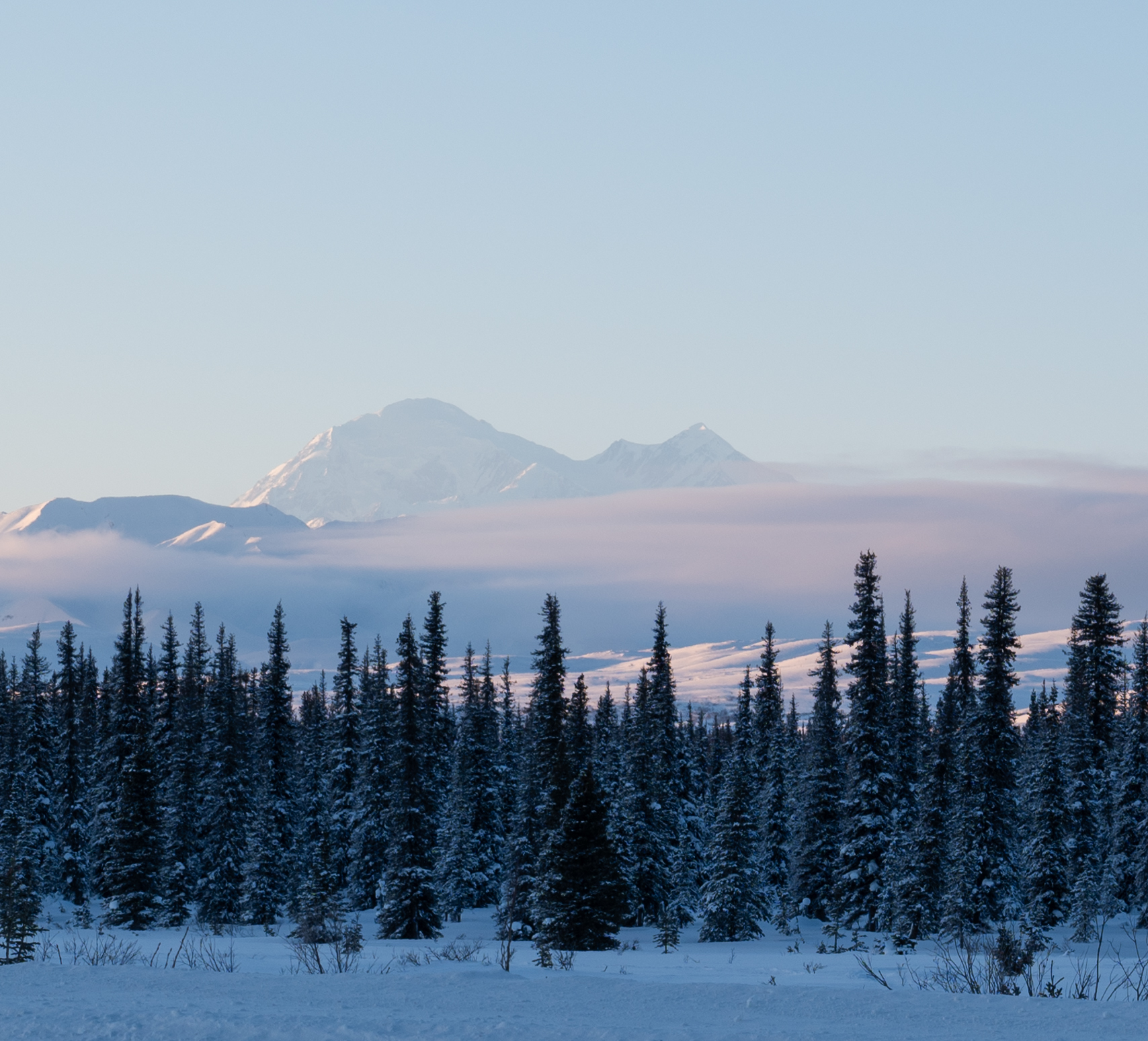
A few days prior I had driven the two hours from Fairbanks to Denali National Park with hopes of viewing the tallest mountain in North America. But to my disappointment, it is impossible to view Denali from Denali National Park in the winter because the road is closed just past the visitor’s center, several miles before the mountain comes into view. A park ranger let me know that if I continued south towards Anchorage there could be a view of Denali from Broad Pass. Denali has its own weather system she informed me so “you never know when she will appear.”
After another hour of driving south, I did in fact get to see Denali! She did appear but far in the distance. I felt satisfied. Or so I thought. Until I learned about the summit flight.
It was an ominous start to the day, waking up to snow and near zero visibility. I checked my phone to see if they had canceled the flight.
I picked up my new friend and we headed to the small airport, both harboring the fear that we would not be able to see anything. Surely we would not set off if there would be no view?!
When we arrived at the office the attendant flicked a few keystrokes, smiled, and flipped the screen around. The image was from a camera near the national park showing that it was a perfect sunny morning in Denali. Amazing!
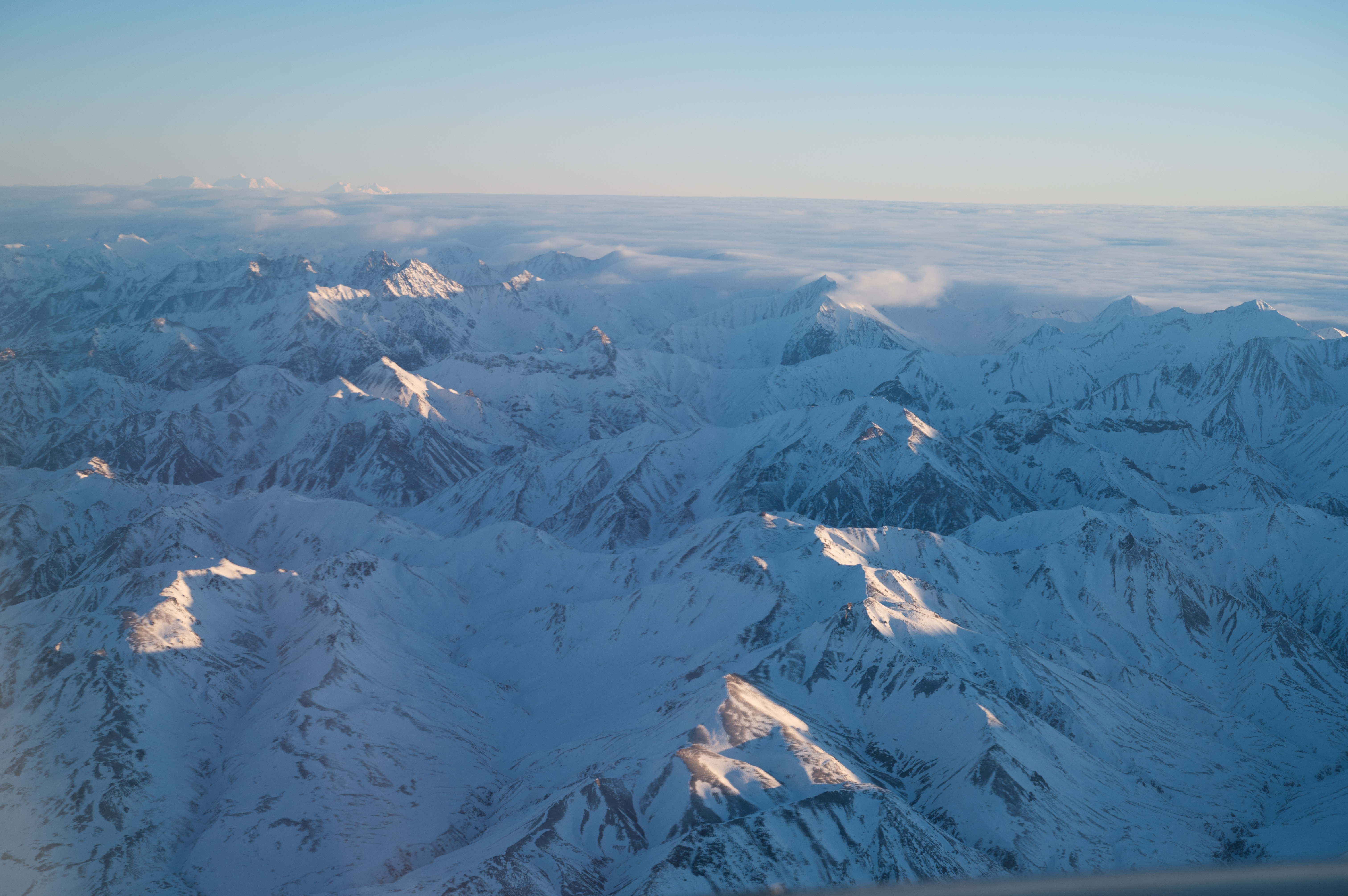
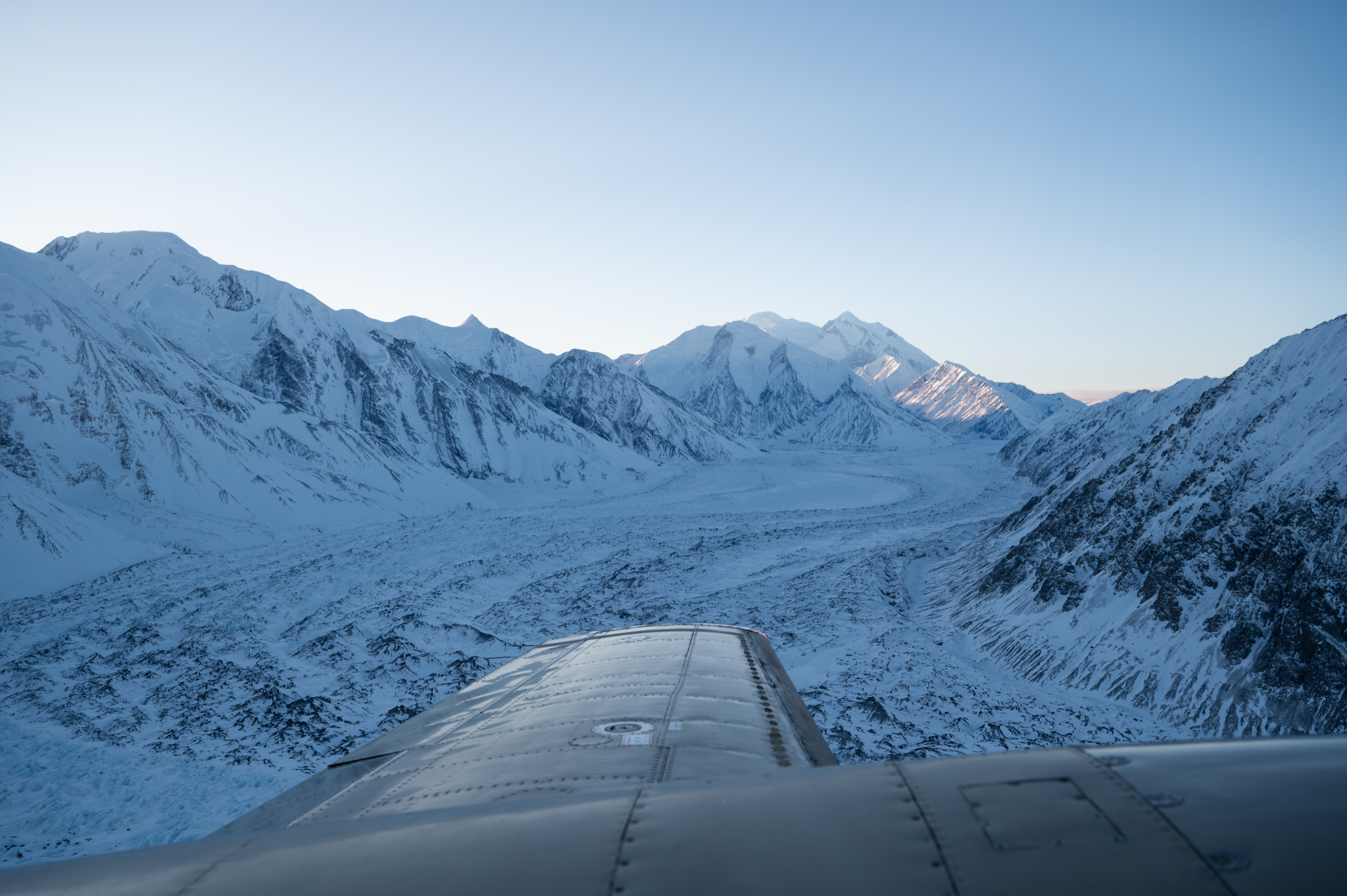
Once our tiny, unpressurized plane cleared the snow and clouds around Fairbanks we emerged into a world of spectacular mountains everywhere. We were at Denali National Park, viewing it from the sky.
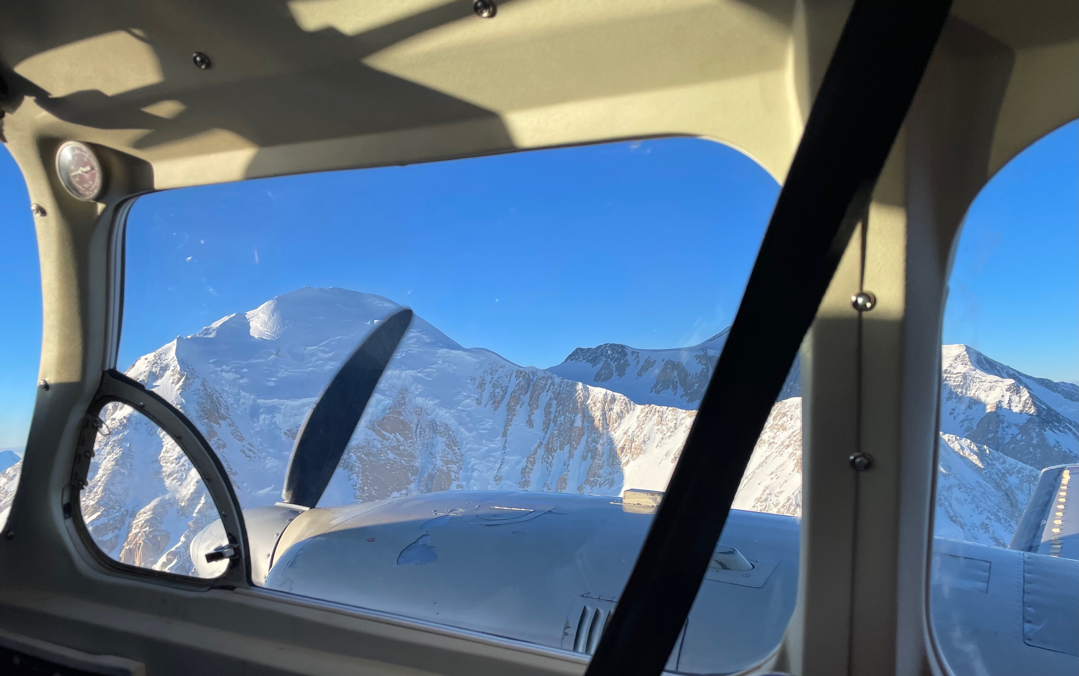
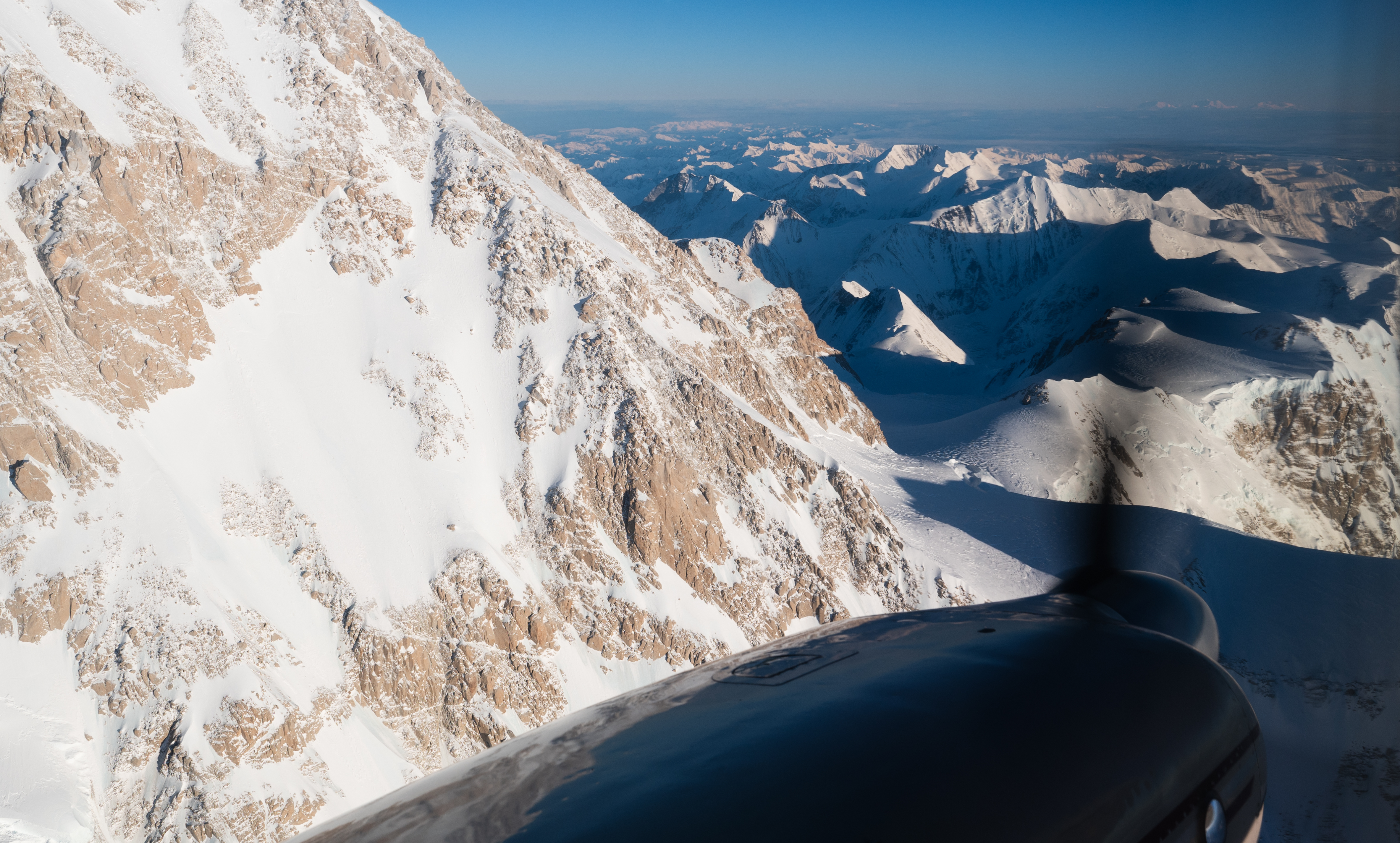
Directly in front of us, filling the entire windshield with its mass was Denali, towering far above all the other peaks. The pilot, whose head was only 18 inches from my own, instructed us to put on our oxygen masks as we climbed to 20,310 feet (6,190 m) to reach the summit height of Denali.
To give a sense of the sheer mass of Denali the picture above was taken when the plane was still several thousand feet below the summit height of Denali. It towers above its neighbors like nothing I have ever seen!
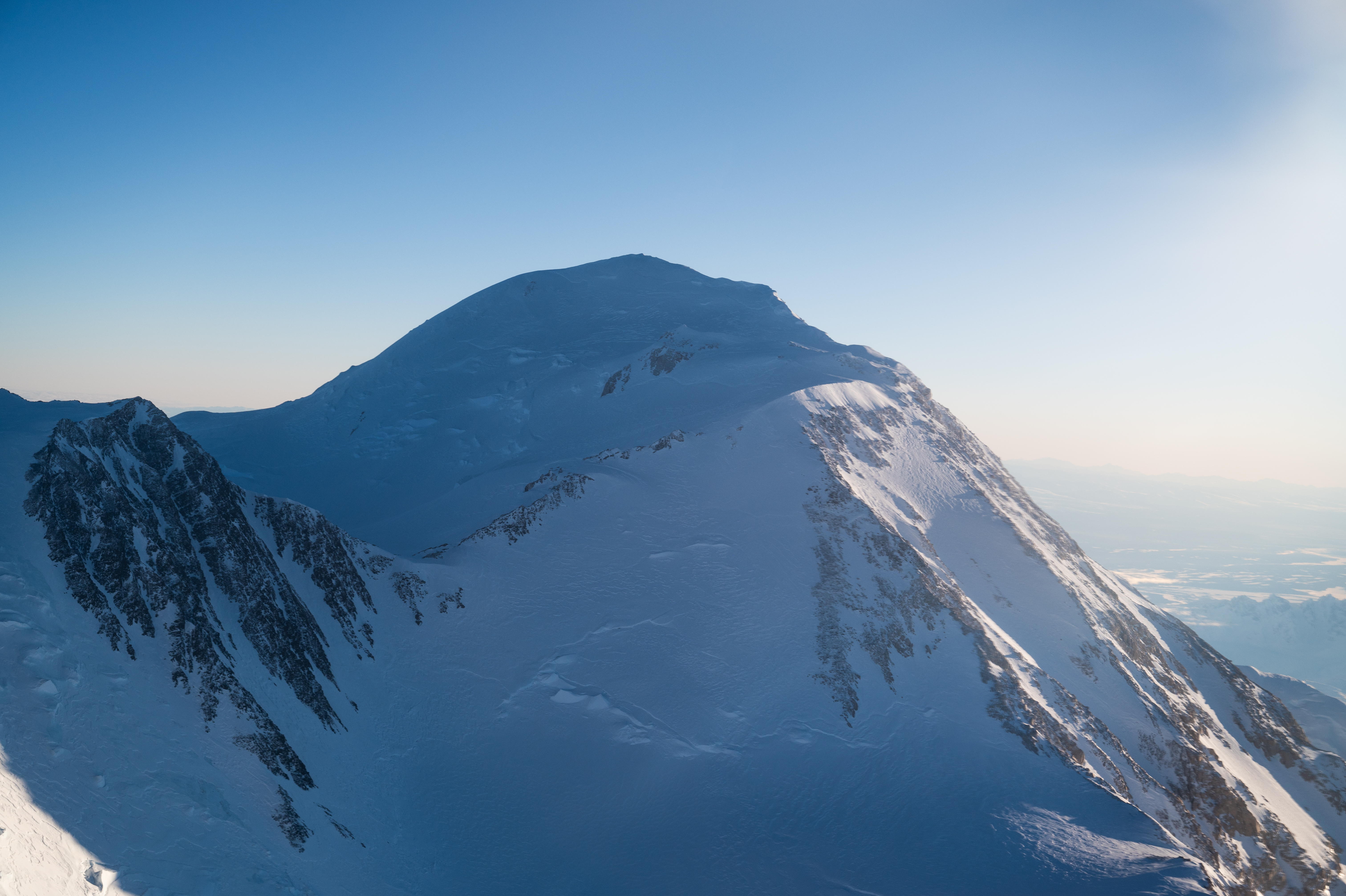
We circled Denali once and then flipped around and circled it again so each side of the plane could take in the view.
To my surprise, we continued with a low-elevation tour of the park. The pilot was taking full advantage of this unusually clear day in December.
Upon our arrival back at the airport, the pilot conveyed his astonishment at the clear weather. He remarked that it was not something he had experienced very many times, especially in late December!
Lessons from: Denali by Air!
- The Native cultures believe it is good luck to view Denali. Only about a 1/3 of people who try actually succeed as it is generally obscured by weather.
- Having only ever flown in pressurized planes, I was a bit anxious about the prospect of a flight to such elevations. It did require more conscious ear popping, an oxygen mask, and a winter coat but turned out to be no big deal.
- Northern Alaska Tour Company offers other flights and tours in central Alaska including to the Arctic Circle, the Arctic Ocean, the Yukon River, and Polar Bears tours.
Something interesting: Is Denali actually taller than Everest?
If you want to get a response, ask that question to an audience of Everest connoisseurs. I made that mistake crossing the Drake Passage en route to Antarctica. I am surprised I was not thrown overboard, another casualty of the infamous crossing! But hear me out. It is actually a very compelling argument.
The base of Denali sits at roughly 2,000 feet above sea level or 610 meters. With the summit at 20,310 ft (6,190 m), the height of the mountain from base to summit is 18,400 ft (5,600 m).
The base of Everest sits at 17,600 ft (5,380 m). The summit height is 29,029 ft (8,848 m). That makes the height from base to summit 11,429 ft (3584 m).
A look behind the curtain.
Those of you closest to me know that my current purpose is not just to travel. I am looking for where to land.
Early last year, the long-term relationship I was in ended. My main client, responsible for about 90% of my work restructured. That ended. My 10-year-old Great Dane Charlie had already passed away. In what felt like a blink of an eye, all of my attachments were gone.
When I returned from Norway in August I knew that I was not going to discover what was next on Bear Road in Yamhill, OR. I knew that I had to get out into the world and find it.
It was on this summit flight around Denali that some clear direction struck me for the first time.
After we had finished our tour of the park, we began to make our way back to Fairbanks. While the pilot was chit-chatting with us over the headphones I looked at him, well I looked at the back of his head, and I thought, this guy is getting paid to spend time in beautiful places. How simple and wonderful! And I knew at that moment that I wanted to get paid to spend time in beautiful places. It was not much more than a passing thought but it would become the root of something. Something that was defined further during my time in Antarctica.


Leave a comment